
Halstead topographic map
Click on the map to display elevation.
About this map
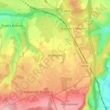
Name: Halstead topographic map, elevation, terrain.
Location: Halstead, Sevenoaks, Kent, England, TN14 7DD, United Kingdom (51.31015 0.11630 51.35015 0.15630)
Average elevation: 156 m
Minimum elevation: 68 m
Maximum elevation: 227 m
Other topographic maps
Click on a map to view its topography, its elevation and its terrain.
Knole Park (Deer Park)
United Kingdom > England > Kent > Sevenoaks > Sevenoaks Weald
Average elevation: 161 m