
East Khasi Hills topographic map
Interactive map
Click on the map to display elevation.
About this map
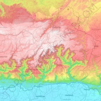
Name: East Khasi Hills topographic map, elevation, terrain.
Location: East Khasi Hills, Meghalaya, India (25.12667 91.36505 25.69317 92.15713)
Average elevation: 948 m
Minimum elevation: 4 m
Maximum elevation: 1,953 m
Other topographic maps
Click on a map to view its topography, its elevation and its terrain.